
From urban plans into immersive environments for better communication and co-design.
Playsign is an efficient tool for drafting, testing, communicating and creating future plans with citizens and other stakeholders. It is an environment that can be visited, played, and experienced before any actual building takes place.
WITH PLAYSIGN YOU CAN:
-
Showcase plans online
-
Draft new areas, test various alternatives
-
Communicate the plans efficiently with different audiences
-
Gather information of the needs and preferences of citizens
-
Experience the plans as an immersive 3D -experience
-
Monitor existing buildings, build a virtual community
Contact us for more!
Playsign Intro Trailer v1 from Playsign on Vimeo.
Playsign is designed to support every phase of urban planning process.
Here’s some examples of use:

Example 1: Creation
Plan areas in 3D & Publish online
Build roads, parks and residential blocks
Use several map types as the base for
all plans
Citizens can plan their own versions and
comment on others.

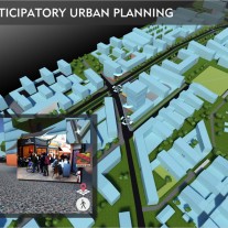
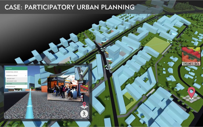
Example 2: Experience
Showcase plans online
Citizens can visit and experience the future areas
Hotspots: What kind of services would the citizens prefer here?
Open feedback & analytics tools
Simulated traffic and ambience to bring the plans to life

Example 3: Live
Monitor existing buildings: ideal for co-working spaces
Introduction to premises
Build a virtual community
Share on-time information on problems, local temperatures, free working spaces etc.
Dynamic use of BIM
(Building information modeling)
WHY PLAYSIGN?
-
Interactive 3D-plans are easy to access & understand by all stakeholders
-
Engage desired audiences, analyse their behavior and preferences
-
Covers up every phase of urban planning process
-
Extremely light and easy to use web-based service
-
Compatible with most commonly used 3D -planning tools
REFERENCES:
-
-
Peab / Välivainio case
-
-
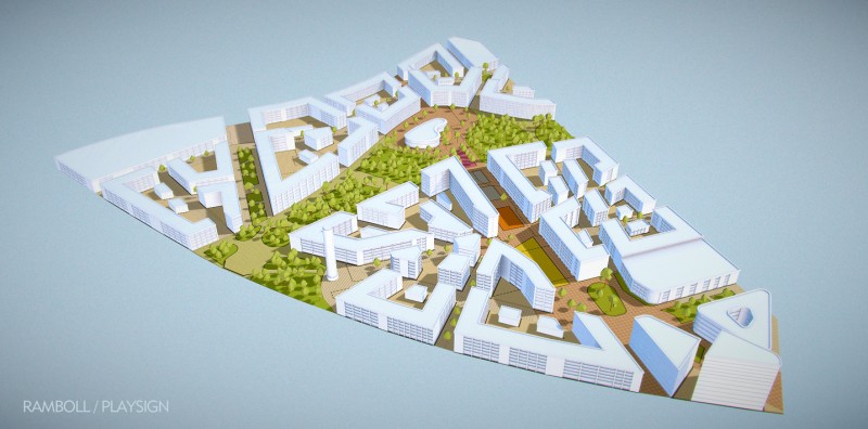
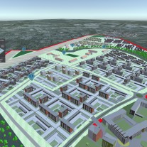
Case Vanha Hiukkavaara / City of Oulu
A tool for early planning phase of a new residential area. Allows to plan areas straight to 3D: Build roads, parks and different residential blocks. Uses several different map types as the base for all plans. Has been used in workshops, online version published late november 2016.


![]()

![]()

![]()
![]()
PUBLICATIONS:
Alatalo, T., Pouke, M., Koskela, T., Hurskainen, T., Florea, C., & Ojala, T. (2017). Two Real-world Case Studies on 3D Web Applications for Participatory Urban Planning. Proc. Proceedings of the 22nd International Conference on 3D Web Technology, Brisbane, Australia (Web3D ’17), New York, NY, USA, 1-9. http://ubicomp.oulu.fi/files/ic3Dwt_2017.pdf


